My previous post (First day out.. first trout in) alluded to the DNR reinstating their trout stocking on the eastern side of Wisconsin. Something that has been sorely needed for several years now. The last notable stocking was done in 2003 with a good population of browns. And I was elated to see the data showing tens of thousands of rainbows relocated to streams closer to home.
So this weekend I went out in search of their new habitats. Armed with my trusty DeLorme's Gazetteer and a list of waters that the DNR recently visited, I set off on Saturday on my first day of streamside reconnaissance. I drove down to Ozaukee County, the southernmost area listed on the DNR site, with the expectation of working my way back north, marking my well-thumbed atlas with future fishing hotspots.
The day was perfect for driving, if not fishing. The temperature was a crisp 42 degrees, but it was a sunny day with little wind. I got off I-43 at Port Washington and aimed my car toward the most likely bridge in the area. I never had to stop the car there, as there clearly was no place to park. And the hike down to what one can only assume was a creek, looked like rappeling gear was a better choice than felt-soled wading boots.
On to the next bridge. The water was much more accessible there. But not exacty what I'd call good fishing. The stream was about 4 feet wide, with trees right up to the water's edge. No wonder there weren't any trucks parked there. No problem. There's plenty more water on the map. Next bridge, please.
I wasn't even sure I was at the right place when I got to the next bridge. Was there even water there? Where did it all go? Or rather, where had it been coming from, since I was driving upstream?
This how my day went. Bridge to bridge. Parking the car and staring at nothing resembling a decent trout stream. Eventually I didn't even stop the engine, but just put the car in 'park' and hopped out to confirm that I wasn't missing anything. All the way back to Sheboygan County. Not a single fish of any kind was spotted.
But that's okay, I figured. I still had all day Sunday to head north and find the other streams where the DNR put in over 30,000 rainbows. The streams were going to be so full of fish that if you put in one more, another fish would pop out on the far shore.
Sunday was even nicer than the previous day. Almost 50 degrees and as sunny as it was going to get. I thought it would be good to hit the one local stream that has been known to have some browns, and also occasionally holds some steelhead earlier in the year. As I got out of my car at a popular wayside, I caught sight of another angler walking toward the water with his 8wt rod in hand. James, was his name. And ironically, I had met him at that same exact spot about 3 years earlier. We walked the bank, futility looking for any sign of fish life. A quarter mile up and back produced absolutely nothing. And this was another stream the DNR recently stocked.
So we both hopped back in our vehicles. I'm not sure where James went, but I headed north toward Manitowoc. The DNR website showed three or four streams between Manitowoc and Kewaunee that would hold more trout in a hundred yards than I'd seen all season. Which would require only three. But at this point I'd be really happy just for those three.
I had my iPod in the fishmobile and was listening to the latest podcast by
Fly Fish Radio and generally enjoying the day. It's a good thing I was out for a drive more than out to catch fish. Five hours of driving, with bridge stops about every 20 minutes convinced me that aliens have been showing up in the middle of the night to remove not only the trout, but the water itself. Half the trout streams that the DNR has been stocking with thousands of fish are little more than 3 feet wide swaths of frogwater. The water I scouted out the previous day looked ten times more promising.
I'm not such a bad fisherman that I need a map with a big red 'X' on it, and words underneath saying "Fish here, idiot!" But I'm starting to wonder about the accuracy of the DNR website.
 Imagine catching a 20 pound bass and releasing it. Then catching it again years later when it hits
 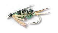 The prince nymph is a searching pattern. It is a great pattern to use when fishing new waters or when you are unsure what the trout are eating. In still or moving waters, the Prince Nymph is always a good fly to start with.